Borama District (Borama District)
Borama District (Degmada Boorama) is a district of the Awdal region in Somaliland.
The Awdal region in which the district is situated is inhabited by people from the Somali ethnic group, with the Gadabuursi subclan of the Dir especially well represented and considered the predominant clan of the region.
Federico Battera (2005) states about the Awdal Region: "'Awdal is mainly inhabited by the Gadabuursi confederation of clans.'"
A UN Report published by Canada: Immigration and Refugee Board of Canada (1999), states concerning Awdal: "'The Gadabuursi clan dominates Awdal region. As a result, regional politics in Awdal is almost synonymous with Gadabuursi internal clan affairs.'"
Roland Marchal (1997) states that numerically, the Gadabuursi are the predominant inhabitants of the Awdal Region: "'The Gadabuursi's numerical predominance in Awdal virtually ensures that Gadabuursi interests drive the politics of the region.'"
Marleen Renders and Ulf Terlinden (2010) both state that the Gadabuursi almost exclusively inhabit the Awdal Region: "'Awdal in western Somaliland is situated between Djibouti, Ethiopia and the Issaq-populated mainland of Somaliland. It is primarily inhabited by the three sub-clans of the Gadabursi clan, whose traditional institutions survived the colonial period, Somali statehood and the war in good shape, remaining functionally intact and highly relevant to public security.'"
There is also a sizeable minority of the Issa subclan of the Dir who mainly inhabit the Zeila district.
Map - Borama District (Borama District)
Map
Country - Somalia
 |
 |
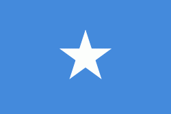
| Flag of Somalia | |
In antiquity, Somalia was an important commercial center. It is among the most probable locations of the ancient Land of Punt. During the Middle Ages, several powerful Somali empires dominated the regional trade, including the Ajuran Sultanate, the Adal Sultanate, and the Sultanate of the Geledi.
Currency / Language
| ISO | Currency | Symbol | Significant figures |
|---|---|---|---|
| SOS | Somali shilling | Sh | 2 |
| ISO | Language |
|---|---|
| AR | Arabic language |
| EN | English language |
| IT | Italian language |
| SO | Somali language |


